I believe I mentioned the Springwater Corridor in my post on the Eastbank Esplanade. In any case, the Esplanade essentially connects to the Corridor, tho technically speaking there’s a small section that’s part of the Willamette Greenway belonging to neither path. So I hiked across the Hawthorne Bridge & once back on the east side, I headed south.

 The Greenway path is quite lovely in itself, & also passes the OMSI (Oregon Museum of Science & Industry), so I’ll leave that for a separate post. It must be said that the north end of the Springwater Corridor isn’t an especially inviting prospect: your initial vista is simply McLoughlin Boulevard, & as you wend your way up the street, you eventually head past the Ross Island Sand & Gravel Company cement plant! After that, however, things begin to look up considerably.

The Springwater Corridor is part of a 40-mile loop of walking & biking trails in the greater Portland area; the loop itself begins in the southern suburb of Boring (in the sense that any loop “begins”) & travels eventually all the way to the St John’s Bridge in North Portland. Per Wikipedia, “it follows a former railway line of the same name in its route from Boring, through Gresham, to Portland, where it ends near the Eastbank Esplanade.”

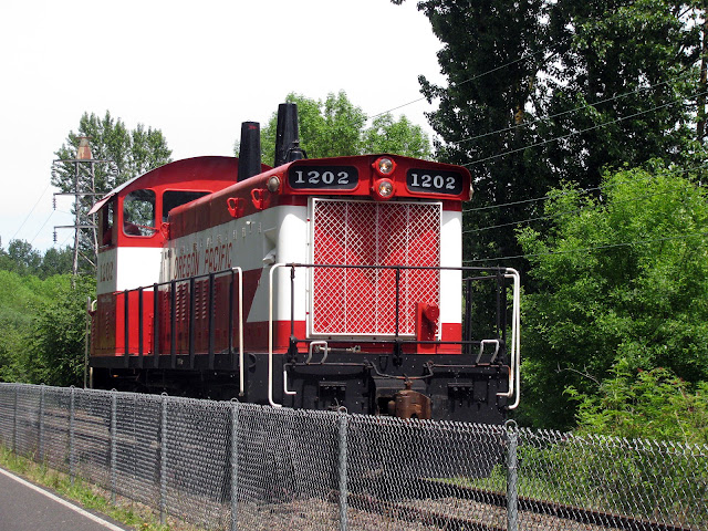
It was a warm day, & even a trifle muggy, at least by western standards; to my right as I headed toward my destination in the southern Portland neighborhood of Sellwood, there were woods & occasional small meadows, & of course always the Willamette River; to my left, the railroad itself, behind cyclone fencing. Birdsong; meadow flowers; views of the Southwest Waterfront & the Ross Island Bridge; an art installation in a meadow near the pier of an abandoned bridge; herons feeding in the backwater; the Ross Island Sand & Gravel Co. boathouse; redtail hawks overhead; the Oaks Bottom Wildlife refuge & the Oaks Amusement Park both accessible at various points (tho I didn’t avail myself of them); & at a certain point a small locomotive running north up the line. There was an almost steady stream of bicyclists & quite a few joggers, particularly nearer the north end; I was one of the few walkers.

As you can see from the photos, there’s a lot to see along the way. At the end of the line, I’d walked about 4 miles of the Corridor to reach Sellwood, & probably a good half mile from the west end of Hawthorne Bridge to reach the Corridor proper. As someone who deals with a significant respiratory condition, this seemed like an achievement indeed! I was helped by the fact that the grade on the Corridor is nominal—essentially flat ground for walking or biking.
Now here I was in Sellwood, very far from my north Portland digs—what to do next?: Tune in next week & you’ll find out.


Urban greenways are cool! Nice shots.
ReplyDeleteThanks, Roy! Yes, cool indeed.
DeleteYour photographs always have an unreal clarity to them - that hot pink sweet pea, the purple flower (vetch?) and the heron standing in his own reflection, especially, in this batch. It's as if your camera catches the hyper observational mode of your poetry. Which is quite a trick.
ReplyDeleteThanks so much--I do love to take photos, tho I'm very much an amateur. Yes, that is vetch--lots of it along the trail. & I think a better heron shot coming up on Sunday. Really appreciate that very much!
Delete